Causes
Parts Of Greene County Had Damage As A Result Of Severe Storms- Report

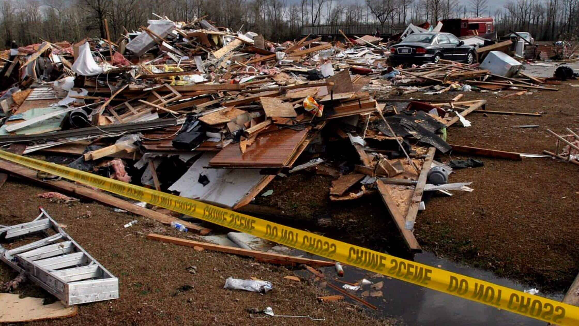
According to the latest reports, heavy storms which started on Tuesday afternoon, have affected many parts of central Alabama, causing considerable damage to properties in Greene County. The area was put under a Tornado Watch, and after 10.00 pm., reports of the damage started to appear from National Weather Service in Birmingham.
According to Eutaw Police Chief Tommy Johnson, the roof of an apartment in the area has come off due to the storm, but nobody was reported to be injured. Some of the residents have moved from the storm-hit area to the Carver Middle School because more storms were expected to head their way. The storm has also affected many parts of the states of Mississippi and Louisiana.
Following Severe Storms, Damage Was Recorded In Certain Areas Of Greene County
Tornadoes and heavy winds had started to hit these areas from Tuesday night and through Wednesday morning, causing the National Weather Service to warn the storm was a “particularly dangerous situation”.
Forecasters and meteorologists have warned the public to remain vigilant throughout the night until Wednesday morning as the climate is expected to soften by Wednesday afternoon, bringing in rains.
Tornadoes at this time of the year in the region are not unusual though, and Alabama, Arkansas, and Mississippi have all witnessed tornadoes in the month of November. Two tornadoes had hit Mississippi by 7 pm; one in Eastern Mississippi, and the other ninety miles from Jackson, and the storms have reportedly affected electrical lines and trees in the region.
A local TV station in Lowndes County, which has around 60000 residents, has reported that people had been trapped inside the storm-affected buildings and grocery stores, but safely got out of the damage. In Eutaw, a tornado was reported to cause structural damage to buildings, according to the Weather Service in Birmingham.
Due to heavy rains in the area, meteorologists were also watching out for the potential risks of the flood. Meteorologists have observed that this particular storm system in the South is somewhat unusual in its nature.
It has a low cloud base, and doesn’t follow a linear distribution and motion causing an uneven distribution of rain and storms in the region, and is also fast-moving. Also, the timing of the storm, occurring mostly at the night is of some concern, since people cannot see it coming, and hence unable to take safety measures.
More: Central Chile Experiences A 6.1-Magnitude Earthquake
Other reports of tornadoes include one in Caldwell Parish, Louisiana. According to the officials, one house has been damaged, and a man got afflicted with minor injuries. Damages to structures and trees were reported by the residents.
Tornado warnings had been issued in western Louisiana, and across the Lower Mississippi Valley on Tuesday evening. The residents of these areas are advised to take all the necessary precautions to keep themselves safe from the storm. Always stay tuned to receive notifications about possible warnings of storms, and stay near the vicinity of a tornado shelter in case of a prediction of a severe storm.
The National Weather Service has a designated system by which it assigns a level from 1 to 5 to warn about the severity of the storms, and higher levels indicate more damaging winds and tornadoes. Most affected areas include central Mississippi, northwest Alabama, and northeastern Louisiana, with a risk level of 4, while the Lower Mississippi Valley has a risk level of 3.
A particular concern about the homes in Mississippi is that most of the houses are pre-manufactured or mobile, which makes their stricture weak and hence vulnerable to even moderate-intensity winds.
Other concerns are urban planning which makes mobile homes isolated from each other, and also the road network of Mississippi, which runs like a labyrinth.