News
Moderate Tremors in the Pacific: 4.1 Magnitude Quake Shakes Oregon Coast
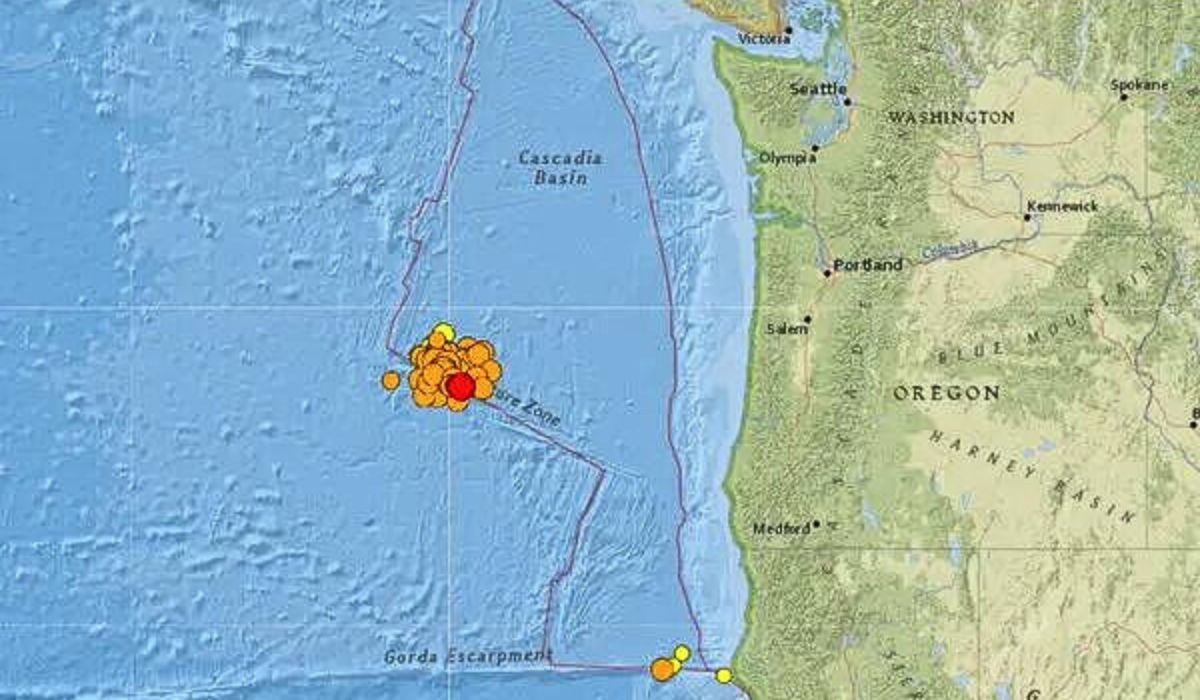
In the late afternoon hours of Tuesday, March 26th, 2024, the tranquil waters of the North Pacific Ocean were disrupted by a moderate seismic event. At 7:49 p.m. local time (GMT -8), a magnitude 4.1 earthquake struck approximately 172 kilometers (107 miles) off the coast of Oregon, United States.
The quake, though relatively small in magnitude, had a very shallow depth of just 10 kilometers (6 miles), according to data from the United States Geological Survey (USGS). Despite its proximity to the Oregon coastline, the tremors went largely unnoticed, with no reports of shaking or damage from nearby communities.
Seismic Details and Epicenter
The USGS confirmed the earthquake’s details, pinpointing its epicenter at 42.3166°N / 126.5022°W, in the North Pacific Ocean. The seismic event released an estimated 8.9 x 10^10 joules of energy, equivalent to 24.8 megawatt-hours or the explosive force of 21.3 tons of TNT.
While the quake was not felt by residents, its shallow depth and proximity to the coast raised concerns among seismologists and emergency preparedness officials. The region is no stranger to seismic activity, sitting along the volatile Cascadia Subduction Zone, where the Juan de Fuca tectonic plate is slowly sliding beneath the North American plate.
Potential Impact and Preparedness
Although this particular earthquake did not cause any reported damage, it served as a reminder of the ever-present seismic risks faced by coastal communities in the Pacific Northwest. The closest larger town to the epicenter was Indian Bay, a town with a population of 1,100 inhabitants, located 171 kilometers (106 miles) east of the earthquake’s origin.
Residents of Indian Bay and other nearby communities were likely spared from feeling the tremors due to the quake’s moderate magnitude and distance from the coast. However, had the earthquake been more powerful or closer to shore, the potential for shaking and damage could have been significantly higher.
“This event, while not particularly strong, highlights the importance of preparedness in our region,” said Dr. Emily Wilson, a seismologist at the University of Oregon. “We must remain vigilant and continue to educate our communities on proper safety protocols in the event of a larger, more substantial earthquake.”
Historical Context and Ongoing Monitoring
The Pacific Northwest has a long and well-documented history of seismic activity, with the Cascadia Subduction Zone being a significant source of concern. In 1700, a massive earthquake estimated at magnitude 9.0 or greater struck the region, triggering a devastating tsunami that impacted coastal areas from British Columbia to northern California.
To better understand and monitor the seismic risks in the region, the USGS and other scientific organizations maintain a network of seismic monitoring stations and early warning systems. These tools play a crucial role in detecting and analyzing earthquakes, providing valuable data to researchers and emergency responders alike.
As the Oregon coast continues to experience seismic activity, residents and officials remain committed to enhancing preparedness efforts and fostering a culture of resilience in the face of potential natural disasters.